

Deliverables You Can Expect

Orthomosaic Maps
Drone images are corrected for image distortion and stitched together during post-processing to create a highly-accurate orthomosaic map. Each pixel contains 2D geo-information (X, Y) and can directly procure accurate measurements, such as horizontal distances and surfaces.
Digital terrain model (DTM)
Drone images are corrected for image distortion and stitched together during post-processing to create a highly-accurate orthomosaic map. Each pixel contains 2D geo-information (X, Y) and can directly procure accurate measurements, such as horizontal distances and surfaces.
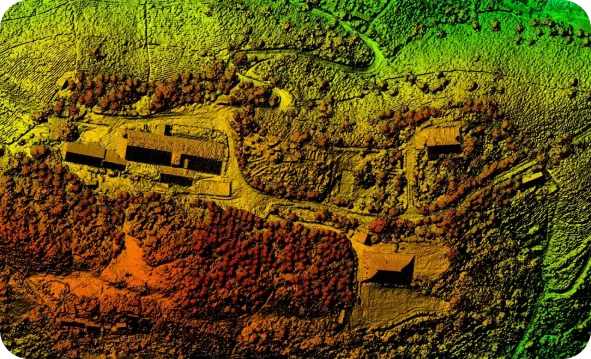
Digital surface models (DSM)
Drone images are corrected for image distortion and stitched together during post-processing to create a highly-accurate orthomosaic map. Each pixel contains 2D geo-information (X, Y) and can directly procure accurate measurements, such as horizontal distances and surfaces.
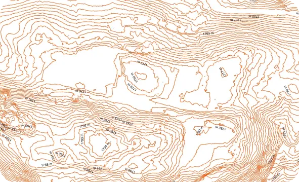
Contour lines
Drone images are corrected for image distortion and stitched together during post-processing to create a highly-accurate orthomosaic map. Each pixel contains 2D geo-information (X, Y) and can directly procure accurate measurements, such as horizontal distances and surfaces.
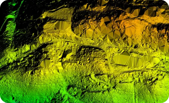
3D Point Cloud
Drone images are corrected for image distortion and stitched together during post-processing to create a highly-accurate orthomosaic map. Each pixel contains 2D geo-information (X, Y) and can directly procure accurate measurements, such as horizontal distances and surfaces.
Drainage
Drone images are corrected for image distortion and stitched together during post-processing to create a highly-accurate orthomosaic map. Each pixel contains 2D geo-information (X, Y) and can directly procure accurate measurements, such as horizontal distances and surfaces.

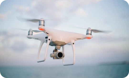
Instrumentation Used
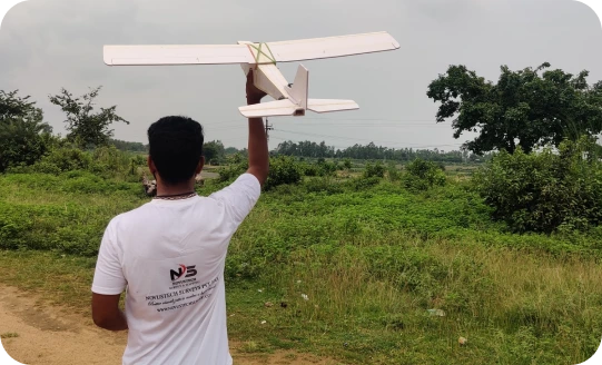
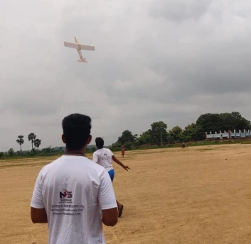
Fixed-wing drones
also help you survey and map sites from farther away while avoiding costly disruptions to job site operations and productivity.
Drone mapping
is the process of surveying an area of land with a UAV. An operator flies the drone over an area of land, taking hundreds of pictures as it moves.
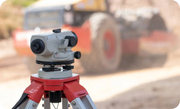
Automatic Level
also help you survey and map sites from farther away while avoiding costly disruptions to job site operations and productivity.is an optical instrument used to establish or verify points in the same horizontal plane, in surveying and building with a vertical staff to measure height differences, etc.
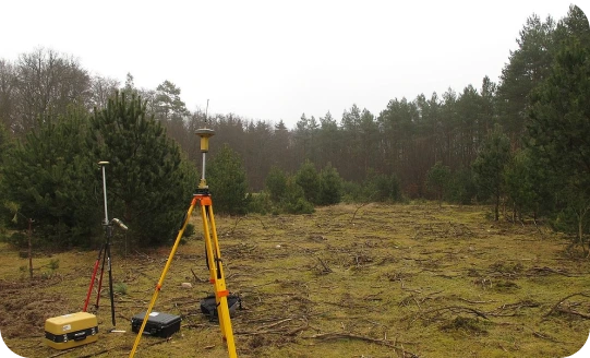
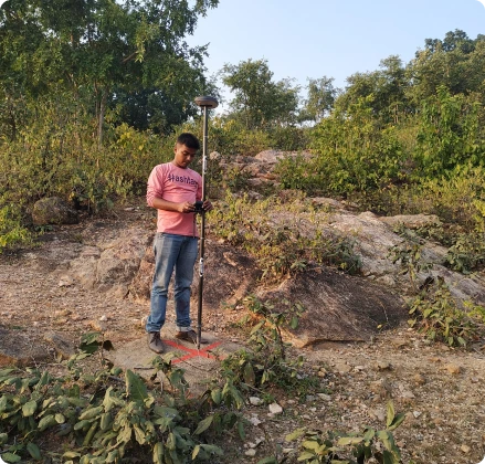
DGPS
is an enhancement to Global Positioning System that provides improved location accuracy, from the 15-meter nominal GPS accuracy to about 10 cm in case of the best implementations.
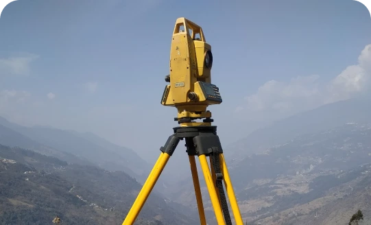
Total Station
is an optical instrument commonly used in construction, surveying and civil engineering. It is useful for measuring horizontal angles, vertical angles and distance, by analyzing the slope between itself and a specific point.
We can reach an absolute accuracy down to 1 cm and 0.7 cm/px GSD under optimal conditions under optimal conditions with a high-end surveying instruments. Higher resolution also yields better map reconstruction.
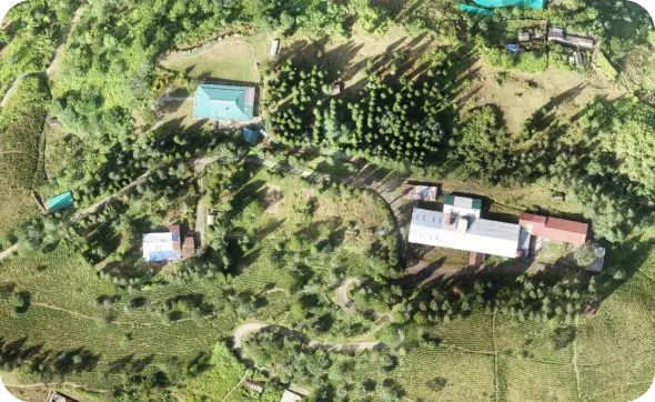
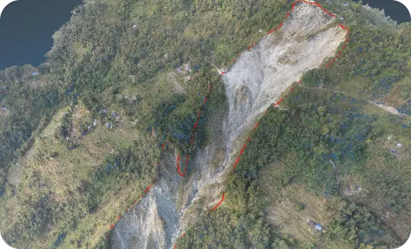
Our Latest Work
Unlock the fastest method of survey and elevate your worksite productivity with the most futuristic solution to all your problems.
Follow Us